

Monument Valley Photography Guide
Iconic Buttes, Forrest Gump Point, Rte. 163 & the 17-Mile Loop Drive
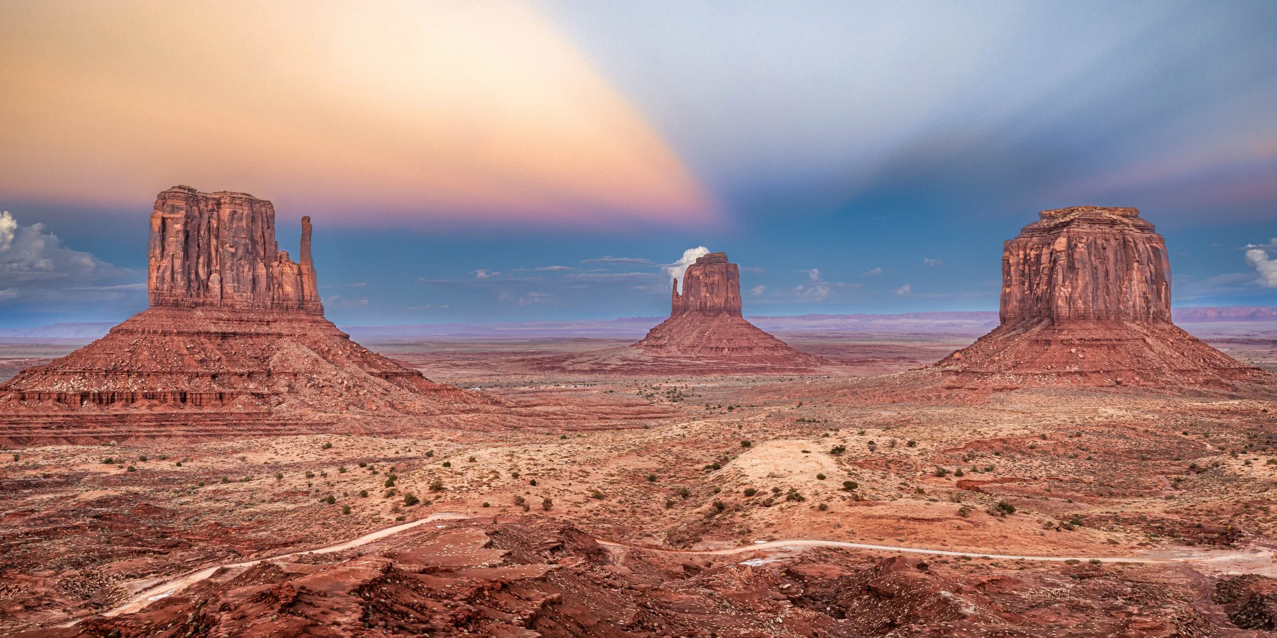
Sunset in Monument Valley - taken from the deck of the View Hotel | ISO 320, 34mm, f/22, 1.3 sec
🎯 In case you were wondering …
Where exactly is Forrest Gump Point in Monument Valley?"
Forrest Gump Point is located at Mile Marker 13 on U.S. Highway 163, approximately 20 minutes north of the Monument Valley Visitor Center. GPS Coordinates: 37.101393, -109.990973 Best Time for Photos: Morning (sunrise to 11:00 AM) is ideal as the sun will be behind you, illuminating the red rocks. In the late afternoon and sunset, the sun will be in your face, creating a silhouette effect.
Before I get to photo recommendations, here are some exact details to help with your personal itinerary:
| Location / Subject | GPS Coordinates | Best Time & Light | Recommended Lens | Photography Tips |
|---|---|---|---|---|
| Mexican Hat Rock | 37.173200, -109.848200 | Late Afternoon Warm light hits the "hat" |
70-200mm Shoot from US-163 pullout |
The "sombrero" rock is best viewed from the southwest side to see the full shape. |
| Goosenecks State Park | 37.174382, -109.927236 | Midday / Night Deep canyon needs high sun |
14-24mm (Ultra Wide) Essential to fit the curves |
Located just north of Mexican Hat; requires a wide lens to capture the double river bend. |
| Forrest Gump Point | 37.101393, -109.990973 | Morning (Sunrise-11AM) Sun illuminates buttes |
70-200mm Compress road & buttes |
Shoot from middle and side (have a spotter!); use telephoto to make buttes look huge. |
| The View Hotel Deck | 36.983262, -110.112995 | Sunrise / Late Afternoon Classic "Mittens" shot |
24-70mm Capture the full panorama |
The Mittens align perfectly with the rising sun; silhouettes are great at dawn. |
| John Ford's Point | 36.954400, -110.087385 | Afternoon Classic western movie look |
24-70mm Wide expanse of valley |
Famous overlook; often has a Navajo rider on horseback for paid photos. |
| Three Sisters | 36.957500, -110.098900 | Afternoon Side light reveals texture |
70-200mm Isolate the spires |
These thin spires look best compressed against the sky or distant cliffs. |
| Artist's Point | 36.961667, -110.062500 | Afternoon / Sunset Vast open view of valley |
16-35mm Dramatic foregrounds |
One of the quietest spots on the loop; offers a unique angle back toward the Mittens. |
And now for the rest of the post!
🏜️ Monument Valley Quick Facts
Location: Arizona/Utah border on Navajo Nation land | 175 miles from Albuquerque (~3.5 hours)
Entry Fee: $8/person (Navajo Tribal Park - National Park Pass NOT accepted)
Hours: Oct-Mar: 8 AM-4 PM | Apr-Sep: 7 AM-6 PM (closed major holidays)
Best Time: Sunrise or sunset for warm light on buttes and rich color palette
Route 163 Photography Stops: Mexican Hat Rock, Raplee Anticline, Gooseneck’s State Park, Agathla Peak, multiple monument viewpoints
17-Mile Valley Loop Road: 2-4 hours | Rough dirt road | No RVs, ATVs, or trailers
Forrest Gump Point Location: US-163, Mile Marker 13 (13 mi north of visitor center)
Essential Gear: 24-70mm & 70-200mm telephoto lenses, polarizing filter
Elevation: 5,564 feet
Park Size: 91,696 acres
Nearest Town: Kayenta, AZ (22 miles south)
⚠️ PROHIBITED: Drones, rock climbing, cremation spreading, camping outside designated areas
🎯 Pro Tip: Stay at The View Hotel for sunrise access. Shoot Forrest Gump Point just after sunrise. Drive the valley loop after lunch. Respect Navajo sacred land—this is their home.
Standing Where the West Was Won (On Film)
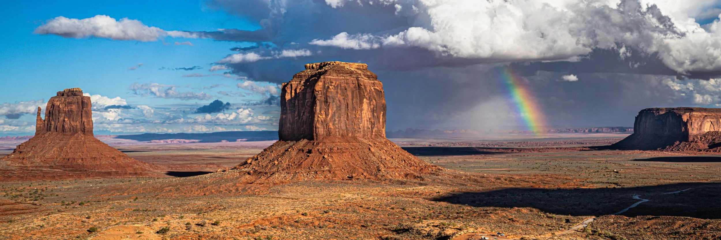
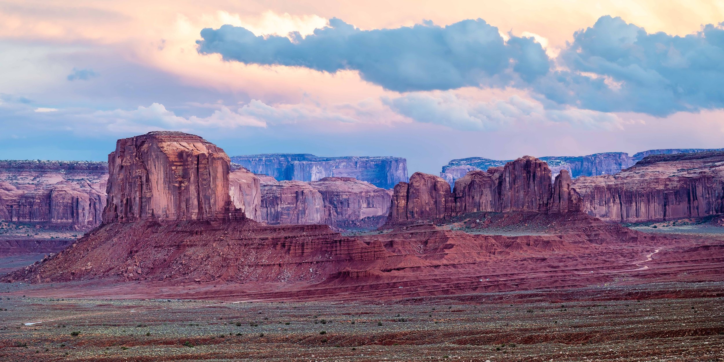
A rainbow in Monument Valley with Merrick Butte (center) and the east Mitten (left) | ISO 64, 39 mm, f/22, 1/50 sec
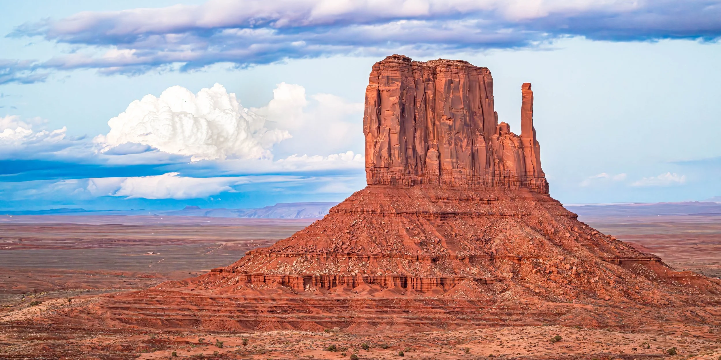
There's a moment—usually about 5 minutes into the drive from Kayenta—when Monument Valley suddenly reveals itself. You round a curve and there they are: the Mittens. Two massive buttes rising 1,000 feet from the desert floor, their distinctive "thumb" projections making them instantly recognizable as the most photographed rock formations in America.
This is the landscape of the American West in film. John Ford shot Stagecoach here in 1939, launching John Wayne's career and Monument Valley into cinematic immortality. Over 100 features have been filmed here since, including The Searchers, Easy Rider, Forrest Gump … oh, and and countless car commercials.
But Monument Valley existed long before Hollywood shared it’s wonders with the world. The towering sandstone formations—some reaching 1,000 feet skyward—are the remnants of a vast rock basin carved by wind and water erosion. What remains are vertical monuments to geological time.
For the Navajo people, these formations are sacred. This isn't a playground—it's their ancestral homeland. You're a guest here, and that changes everything about how you should photograph it.
When to Photograph and Visit Monument Valley
Monument Valley at sunset | ISO 100, 140mm, f/22, 1/100
Best Times at a Glance
Sunrise (6:45-9:30 AM): Forrest Gump Point & east-facing buttes catch first light. Photographing Mittens and Merrick at dawn requires an overnight stay at the View Hotel for sunrise visibility.
Sunset (5:30-6:30 PM): West-facing buttes in the Valley glow orange-red and shadows play in the valley like they're alive—absolutely spectacular. Great photos can be taken from the View Hotel - right near the restaurant or in the parking lot!
Blue Hour (6:30-7:00 PM): Silhouettes against purple sky
Avoid Midday: Harsh overhead sun flattens formations. Great time to tour and photograph along Rte. 163.
Best Season: Fall (September-October)
Why October is Ideal:
Pleasant temperatures (60-75°F days, 40-50°F nights)
Clearer air (less summer haze)
Dramatic clouds (monsoon season ending)
Perfect combination with Balloon Fiesta
Lower tourist crowds than summer
Weather Considerations
Typical Temperatures and conditions in Monument Valley by season:
Spring (Mar-May) 50-70°F Windy, unpredictable
Summer (Jun-Aug) 85-100°F Hot, afternoon thunderstorms
Fall (Sep-Nov) 60-75°F Perfect, dramatic clouds
Winter (Dec-Feb) 30-50°F Cold, occasional snow (beautiful)
Top Photo Ops in Monument Valley
Forrest Gump Point: The Iconic Road Shot
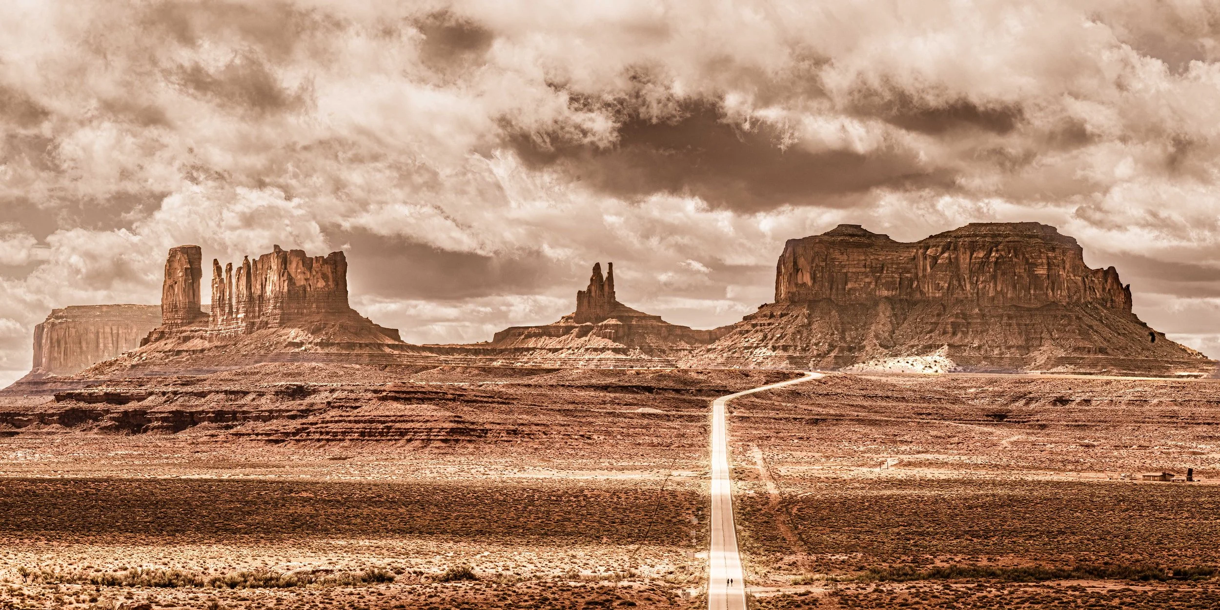
The iconic view from US Rte. 163 & Forrest Gump Point | ISO 500, 135mm, f/22, 1/640 sec
"I'm pretty tired. I think I'll go home now."
In the 1994 film Forrest Gump, Tom Hanks' character stops running at Mile Marker 13 on US-163, with Monument Valley rising in the distance behind him. That spot—now called "Forrest Gump Point"—has become one of the most photographed locations in the Southwest.
How to Find Forrest Gump Point
Location: US Highway 163, Mile Marker 13
GPS Coordinates: 37.1013° N, 109.9898° W
From Monument Valley Visitor Center: 13 miles north on US-163
Directions:
Head north on US-163 from the Monument Valley Visitor Center
Drive approximately 13 miles (watch for Mile Marker 13)
Look for a dirt pullout on the right (east) side of the road
Park safely off the highway
How to Photograph Forrest Gump Point
The Classic Shot:
Stand in the center of US-163 (when safe!)
Frame the road leading toward Monument Valley
Use a telephoto lens (70-200 mm)
Keep the yellow centerline in frame
Buttes should be visible in the distance with the highway creating a visual 1/3 in the lower right of your frame.
Best Time: Sunrise to mid-morning
Warm facing light on the buttes
Dramatic skies
In October, in the mid to late afternoon, the rock faces become dark obfuscating important details (or creating a ton of post-production work)
Bring two lenses a (16-35mm) for the full road perspective and a 70-200 mm for tighter compositions emphasizing the buttes.
Alternative Compositions
Off-center: Stand to the left side of the road to create a different leading line
Low angle: Get down low to emphasize the road texture
Silhouette: Place a person in the road for scale
Long exposure: Use ND filter to blur passing cars into light streaks
Go to the bottom of the hill: Grab close-up images of the rock formations with brush detail in the foreground
Pro Tip: Be patient! This is a tremendously busy photo location and the selfie / Insta-crew will not observe any kind of photo etiquette.
⚠️ Safety Warning: You'll be standing IN THE MIDDLE OF THE HIGHWAY to get the iconic shot. Watch for traffic carefully. Vehicles come over the rise fast. Have a spotter. Don't risk your life for a photo. Have a spotter or ask someone to keep their eye on you.
The 17-Mile Valley Loop Drive
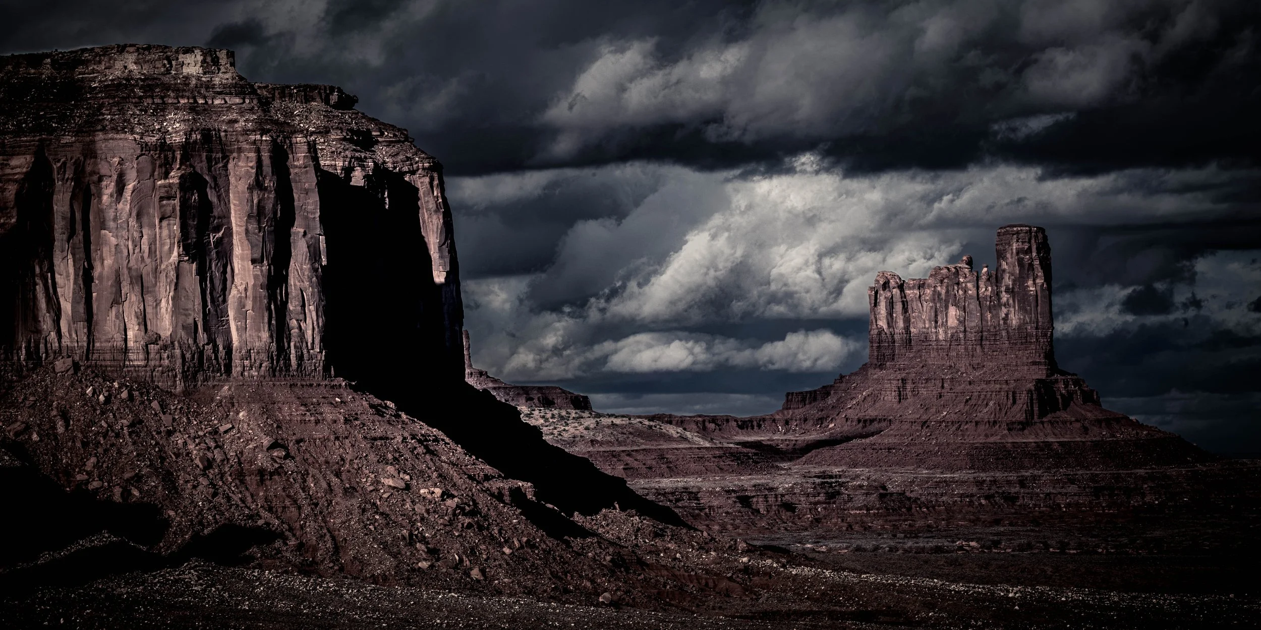
Elephant Butte along Valley Loop drive at susnet in Monument Valley | ISO 100, 101mm, f/5.6, 1/40 sec
The Valley Loop is a dirt road that winds through Monument Valley, offering close-up views of the iconic formations. It's rough, sandy, and absolutely worth it.
Loop Drive Essentials
Distance: 17 miles
Time: 2-4 hours (depending on photo stops)
Road Surface: Dirt, rocky, washboard sections
Speed Limit: 15 mph
Direction: One-way (counterclockwise)
Difficulty: Moderate (high clearance recommended)
⚠️ Prohibited Vehicles: NO RVs, trailers, ATVs, UTVs, or motorcycles. SUVs are fine, but expect a bumpy ride.
Best Stops on the Loop
1. John Ford's Point
Iconic overlook used in countless Westerns
Navajo horseback rider for photos (tip appreciated)
Vendor stalls with jewelry and crafts
Shot: Wide-angle of valley panorama
2. Three Sisters
Three vertical rock spires side-by-side
Telephoto compression works beautifully
Shot: 70-200mm at 135-200mm focal length
3. Artist's Point
Wonderful view of multiple formations
Best afternoon light
Shot: Panorama stitching opportunity if you want to try
Pro Tip: Stop at ALL the numbered viewpoints—even if they look similar from the car. The angles change dramatically, and what seems redundant from the road reveals itself as unique once you're standing at the overlook.
Route 163 Roadside Photography: The Approach to Monument Valley
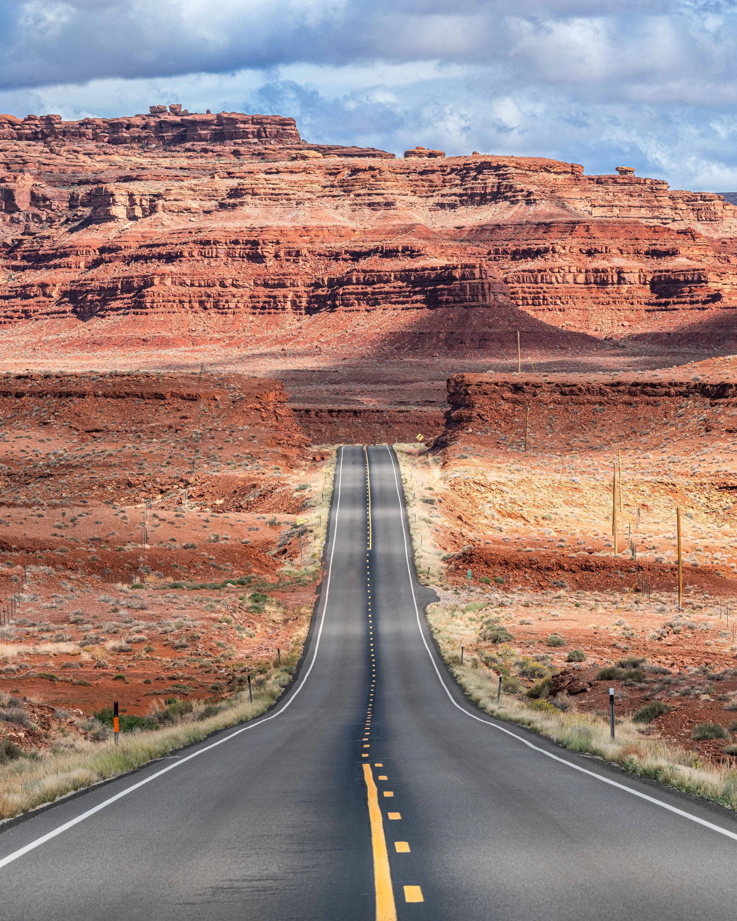
The drive along US Highway 163 isn't just a means of reaching Point B from Point A—it's a truly epic photographic journey. The highway is world-renowned for being exceptionally beautiful, iconic, and often ranked as one of the most scenic drives in the United States. From Mexican Hat to Monument Valley, this 25-mile stretch offers roadside pull-offs with some of the most incredible Southwest views you'll ever see.
Unlike many scenic drives where you glimpse formations from a distance, Route 163 delivers an immersive experience. The road rises and falls across the desert floor, bringing you face-to-face, and through, stunning geological features that span 300 million years of Earth's history.
Photography Strategy: Allow 1-2 hours for the 25-mile drive (normally 30 minutes). Stop at every pullout and find a few of your own! Here are some “must see” spots.
1. Photograph Mexican Hat Rock
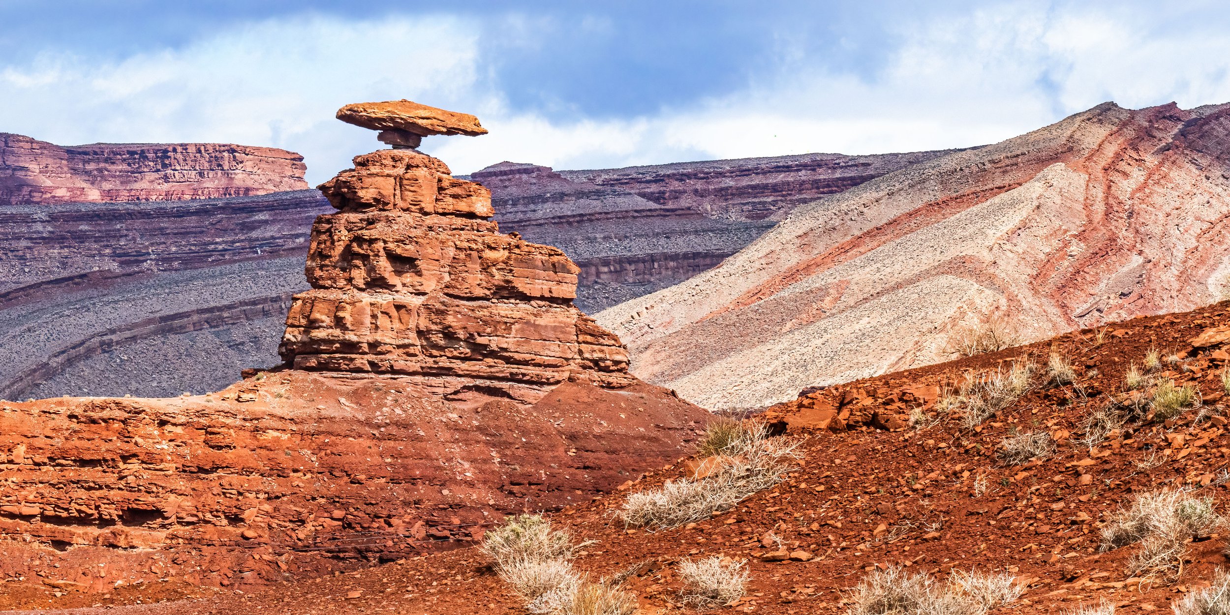
Photo of Mexican Hat Rock - the “Hat” is approximately 60 ft in length | ISO 500, 200mm, f/22, 1/400 sec
Location: 1 mile north of the town of Mexican Hat on US-163
GPS: 37.1583° N, 109.8636° W
If you drove in from Shiprock, you might feel that the drive couldn’t possibly get any better. Well, this is where the visual feast gets even tastier. Mexican Hat is a 300-foot-tall balanced rock formation crowned with a 60-foot-diameter "sombrero" that defies gravity.
The Geology:
Caprock (the "Hat"): Cedar Mesa Sandstone - light tan, erosion-resistant
Pedestal: Halgaito Formation - red shale and siltstone
Age: Permian Period (250-286 million years ago)
Formation Process: Differential erosion—the softer shale eroded faster beneath the harder sandstone cap
How to Photograph It:
From Highway: Visible from multiple roadside pull-offs (my preference)
Up Close: Turn east on dirt road, drive 0.5 miles to base
Best Angle: Southwest side shows the "hat" profile most clearly
Best Light: Late afternoon (4-6 PM) when warm light hits the formation
Lens: 70-200mm from highway, 24-70mm up close
Behind Mexican Hat, look for Raplee Anticline—a colorful, triangular rock formation with wavy, tri-colored layers (red, white, gray). Locals compare its patterns to Navajo rug designs.
2. Raplee Anticline (Raplee Ridge) Image
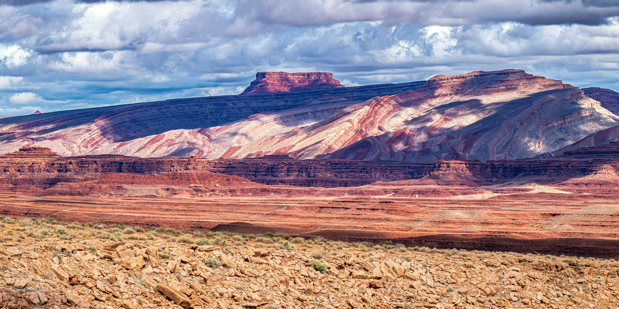
Photo of the Raplee Anticline along Route 163 | ISO 500, 175mm, f/22, 1/800 sec
Location: Coming from Mexican Hat toward Monument Valley it will be on the left side with (and just past) Mexican Hat rock.
This is one of the Southwest's most photogenic anticlines—an upward fold in rock layers - creating a dramatic exposure of geological strata.
What You're Seeing:
Tilted rock layers from a massive fold in the Earth's crust
Red, white, and gray bands representing different geological periods
Approximately 300 million years of geological history visible at once
Photography:
Use telephoto (135-200mm) to compress the layered bands
Shoot with the sun overhead or later in the afternoon when light illuminates the banding. Later in the day shadows will creep on this area.
3. Goosenecks State Park
Note: While often confused with Arizona locations due to its proximity to Monument Valley, Goosenecks is located just across the border in Southern Utah (near Mexican Hat).
This primitive park offers one of the most impressive examples of "entrenched meanders" in North America, where the San Juan River twists 1,000 feet below a massive plateau. It is a quick but essential stop for photographers.
2 Photographic Highlights:
The Double Meander (Main Overlook): You need an ultra-wide angle lens (14mm-16mm) or a panorama stitch to capture the full "double loop" of the river in a single frame. The scale is massive, and standard lenses cannot fit it all in; think Horseshoe Bend and the Colorado River.
Astrophotography: Designated as an International Dark Sky Park, the lack of light pollution makes it a world-class location for Milky Way photography. The flat horizon allows for full-dome star charts.
Don’t forget to look behind you!
Every twist and turn reveals a new side to the hills and buttes along Route 163.
ISO 400, 200mm, f/14, 1/400 sec
4. Agathla Peak (Church Rock)
Location: Visible east of US-163, approximately Mile 17 (south of Mexican Hat)
The Geology:
Rock Type: Volcanic breccia (solidified magma core)
Age: 25-30 million years old
Formation: Ancient volcanic vent; surrounding softer rock eroded away
Name: "Agathla" is Navajo for "much wool" (resembles sheep wool)
Photography:
Multiple pullouts on US-163 for different angles
Telephoto (100-200mm) isolates the dramatic spire
Best at sunrise or sunset when side-lit
Include desert foreground for scale
Roadside Photography Tips for Route 163
Time of Day Expectations:
Late Afternoon (3-6 PM): Warm light, buttes illuminated. Nice for Mexican Hat. But, IMO you should be in the park a couple of hours before sunset!
Early Morning (7-9 AM): Cool light, fresh air, emptier road. Great time to photograph Forrest Gump Point.
Midday: Harsh overhead light flattens formations. Some Rte. 163 formations and hillsides will photograph well mid-day.
Essential Gear:
24-70mm: Versatile for roadside compositions
70-200mm: Compress distant buttes, isolate formations
Polarizing Filter: Deepen blue sky, saturate red rocks
Tripod: Optional (plenty of light, but useful for bracketing and experimentation)
Photography Techniques for Monument Valley
West Mitten Butte in Monument Valley - late day | ISO 1000, 70mm, f/22, 1.6 sec
1. Use a Telephoto Lens
Wide-angles make the buttes look small and distant. Telephoto lenses (70-200mm, even 100-400mm) compress the formations and make them dominate the frame.
Technique:
Shoot the 70-200mm focal length
Compress multiple buttes into layered compositions
Isolate single formations against sky
2. Shoot in Warm Light
The red sandstone GLOWS in warm light. Sunrise/sunset is essential.
Golden Hour: Buttes turn orange-red
Blue Hour: Silhouettes against purple sky
Avoid Midday: Harsh light flattens formations
3. Include Foreground Elements
Sagebrush
Desert wildflowers (spring)
The road (Rte. 163 / Valley Loop)
Sand ripples (if hiking backcountry with permit)
4. Work the Polarizer
A polarizing filter can be helpful in Monument Valley.
Deepens the blue October sky
Increases contrast between sky and buttes
Saturates the red sandstone colors
Rotate the polarizer until the sky reaches maximum blue saturation. The contrast with red buttes will be stunning.
Camera Gear for Monument Valley
Essential Gear
70-200mm f/2.8 or f/4: Your primary lens
24-70mm f/2.8: Wide scenes, Valley tour
Circular Polarizer: Essential for sky/rock contrast
Tripod: For low-light sunrise/sunset
Remote trigger: Avoid button pressing shake
Extra Batteries: Cold mornings drain power
Frequently Asked Questions
-
No, Monument Valley is not a National Park; it is a Navajo Tribal Park. Because it is tribally owned and managed, the "America the Beautiful" National Park Annual Pass is not accepted here. You must pay the tribal entry fee (typically $8 per person) at the welcome center booth.
-
Description text goes here
-
Monument Valley is on Mountain Daylight Time (MDT) and observes Daylight Saving Time. This can be confusing because the state of Arizona does not observe Daylight Saving Time.
Summer Rule: Monument Valley is usually one hour ahead of the rest of Arizona (like Phoenix or Page). It follows the same time as Utah.
Winter Rule: It is on the same time as the rest of Arizona.
-
While a 4x4 is highly recommended, it is not strictly required. The 17-mile Valley Drive is a dirt road that is often rough, washboarded, and sandy. Most standard SUVs and crossovers can handle it fine. Sedans and low-clearance vehicles can attempt it, but you risk bottoming out or damaging your suspension. If you are unsure, guided tours in open-air jeeps are available.
-
No. Flying drones is strictly prohibited within Monument Valley and arguably across the entire Navajo Nation. The tribal government has a "No Drone" policy to protect privacy and cultural sanctity. Rangers are vigilant, and fines can be significant. If you see drone footage online, it was likely filmed with a rare commercial permit or illegally.
-
No. The Navajo Nation is a dry reservation. The possession and consumption of alcohol are illegal within the tribal park boundaries. This applies even if you are just camping or staying at the hotel. Do not bring beer or wine in your cooler; you risk having it confiscated.
-
Yes, with restrictions. Unlike many National Parks (which ban dogs on trails), Monument Valley is surprisingly pet-friendly.
Scenic Drive: Dogs are allowed in your vehicle on the 17-mile loop.
Hiking: Dogs are allowed on the Wildcat Trail (the only self-guided hike) as long as they are on a leash.
Tours: Some open-air jeep tour operators allow dogs, but you must call ahead to confirm.
-
Yes, but bring cash as a backup. The entry booth accepts credit cards, but internet connectivity in the high desert can be spotty. If the card reader is down, they may require cash. The fee is typically $8 per person (not per car), so having small bills is a smart "just in case" strategy.
🙏 Respecting Navajo Sacred Land
Monument Valley is not a National Park—it is Navajo Nation territory. Known to the Navajo as Tsé Biiʼ Ndzisgaii ("Valley of the Rocks"), this is sacred land and the home of the Navajo people.
Please Honor Navajo Laws and Culture:
✅ Stay on designated roads and trails
✅ Purchase from Navajo vendors (jewelry, crafts)
✅ Ask permission before photographing Navajo people
✅ Pack out all trash—keep the land clean
❌ NO drones (strictly prohibited by Navajo law)
❌ NO rock climbing on formations (sacred sites)
❌ NO dogs (prohibited at all Navajo Tribal Parks)
❌ NO spreading cremated remains (desecration)
❌ NO camping outside designated areas
Walking in Beauty (Hózhó): The Navajo concept of Hózhó represents living in harmony and balance with nature. Please visit with this spirit of respect.
Ready to Photograph Monument Valley?
Monument Valley delivers the iconic Southwest landscape you've seen in countless films—and it's even more spectacular in person. The combination of massive buttes, warm desert light, and Navajo cultural richness creates an unforgettable photography experience.
See the Complete 5-Day Southwest Itinerary Start with Balloon Fiesta
📸 Want These Images? Browse available Monument Valley prints
Last updated January 2026.
© 2026 Don Mennig Fine Art Photography